“Why don’t we have a cool, summer alpine bouldering area?!” was all I could think as I sat early last summer stewing in the hot, humid air locked in the windless forest surrounding the Squamish boulders. Summer is the most predictably dry weather here but it’s not exactly sending conditions. Colorado has RMNP. Yosemite has Tuolumne. Why not us? We need an escape.
I searched Google Maps for a solution. A few potentially interesting rock piles appeared in the Squamish area. One pile looked particularly good but with especially arduous access. So I did the easy thing and I went to Tuolumne for the rest of the summer where the boulders are only a few minutes from the road. It was rad.
This spring, as we made our way through record-breaking 30°C weather in April, the same problem started creeping up. What am I going to do to make it through this summer? That pile of rocks was on my mind again.
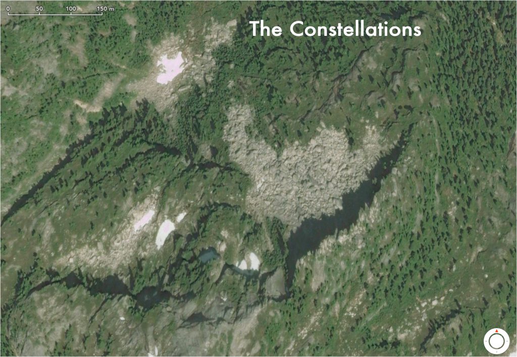
Just look at that pile. It’s huge!
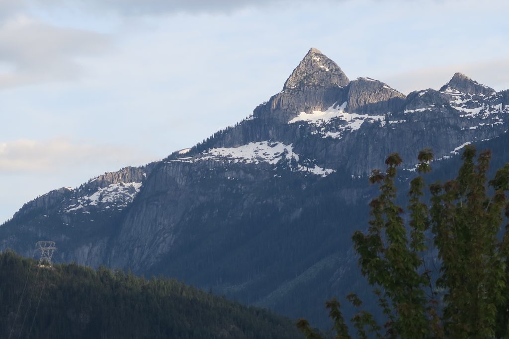
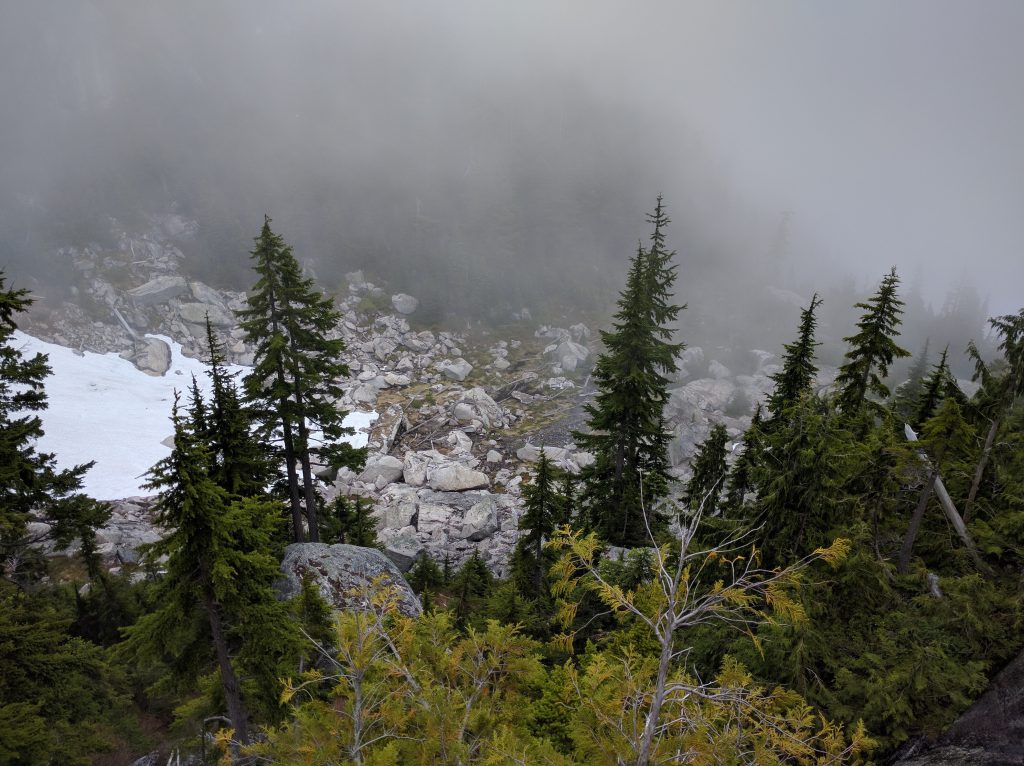
If you’ve been to Brackendale, Garibaldi Estates, or Garibaldi Highlands, you’ve already seen this boulder field every time you look up at Mount Habrich. Quest University offers a great vantage point. The lowest, leftmost snowfield in the following picture is The Constellations.
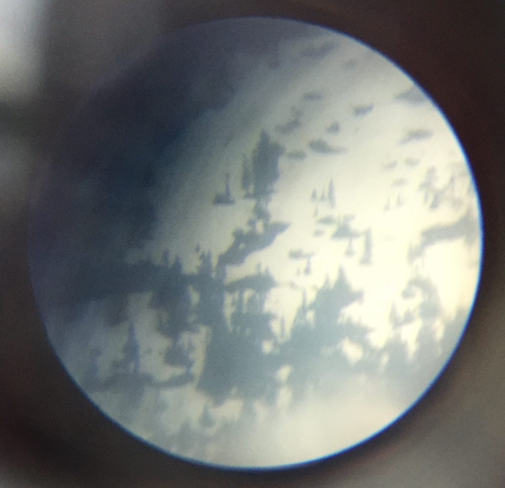
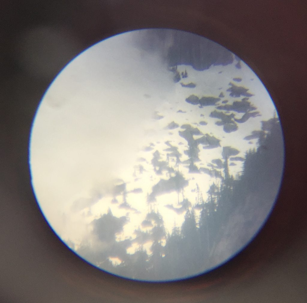
I wanted a closer look but I don’t own binoculars or a scope. I was visiting Curtis Suave’s art studio and he had an old broken telescope laying outside on the ground. I fiddled with the eye piece a bit and surprisingly, the thing actually worked. “Curtis, can I borrow this?” Generous as always, “You can have it, man.”
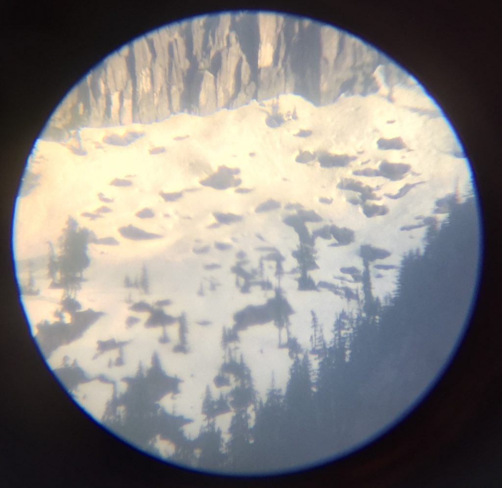
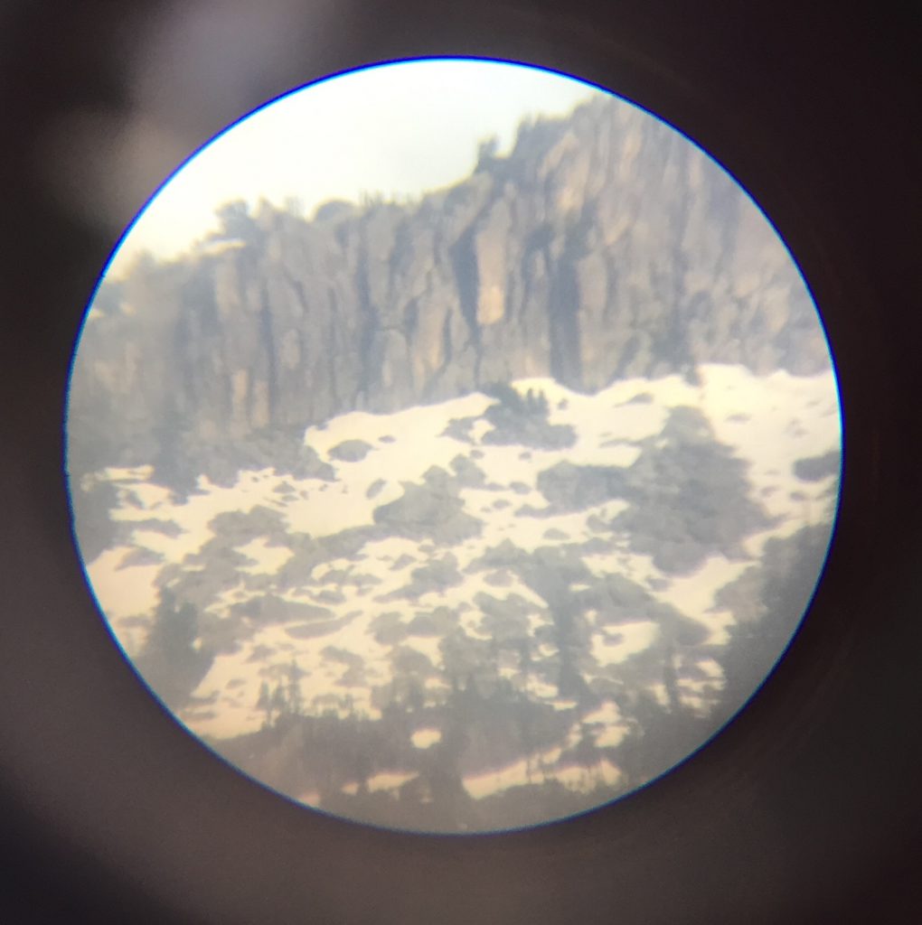
Over the following couple months, I took pictures with my iPhone pointed through the telescope recording the snow melting…
By this point, I had already started work on finding a trail up from the north side of Habrich up the steep hill to the boulders.
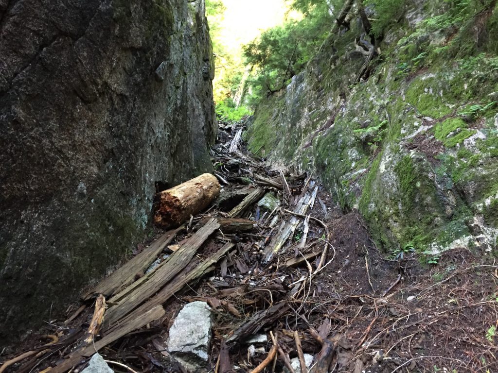
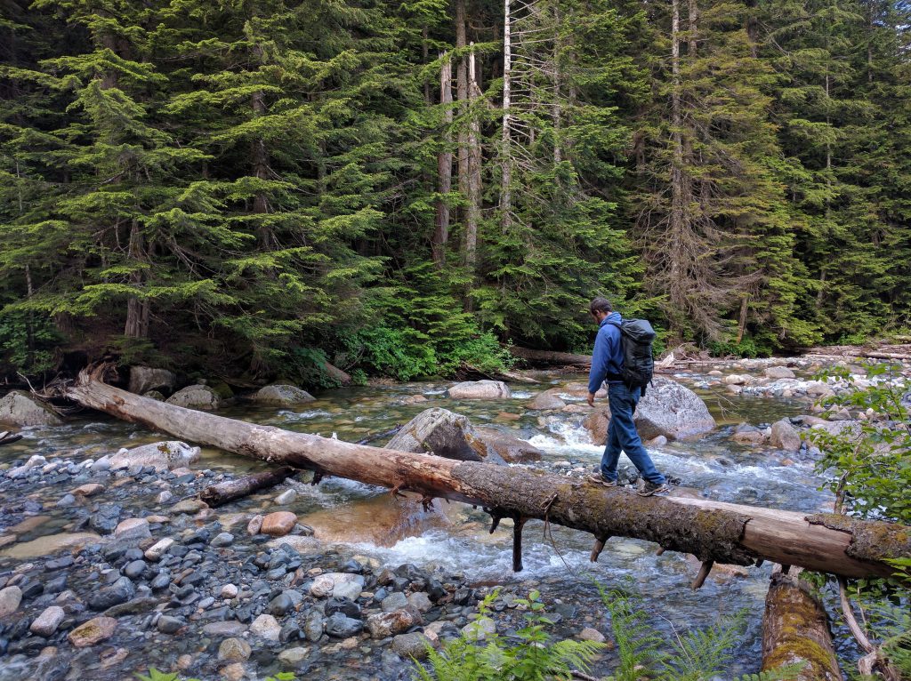
On the first trip, Frank Nardi and I found a solid log bridging the river. We spent a couple hours bashing through devil’s club and variety of other prickly things on the other side.
…and melting…
On the second trip, I started up the hill and found two ways through the first cliff band. Making progress and route finding in that forest is hard work. It’s steep and it’s not possible to see very far. The second way I found is a nasty shoot about 50 meters long filled with loose rocks and tree debris. I don’t enjoy it but I guess I mind it less than the other way which seemed pretty sketchy too.
Being out there alone with bear scat, moose and deer tracks, and confidence that cougars would surely be there to enjoy the feast was a somewhat unnerving experience I’m not accustomed to.
…and melting…
Google Maps had convinced me there were a lot of boulders up there and some of them were reasonably sized. The bits of rock I had seen around the lower parts of Habrich made me reasonably confident that the rock quality would be good. I was talking to a few people about the area and needed a name. If someone asks where I’m going bouldering, I want to have a good answer. “I’m going up to The Constellations” seems like a pretty rad answer to me. (After completing the hike, you’ll understand.)
On the third trip, I went armed with bear spray and flagging tape. I flagged up to the second cliff band. There is a boulder problem on a little cliff band. It just didn’t seem like a good idea to attempt it alone in the mountains with no cell connection. I sure did like having the flags to guide me down through the thick forest.
I didn’t want to go alone again. I started asking for company explaining that this hike is quite brutal and a bit sketchy. I didn’t want to drag someone out there to be miserable.
On the fourth trip, Tim Doyle joined me. We made it over the boulder problem (one move of V0- with 5 meters of exposure) and around the third cliff band which was the last questionable part of the route. We continued up onto the snow on top of the dome where we could see down to Squamish. A lot of snow covered the 300 meters between us and the boulders. We achieved the goal of proving we could hike up that side of the hill. (The other option seemed to be a 26 km round trip from the top of the gondola.)
I still had never actually seen the boulders close up. Were they too big? Were they too small? Is the rock crumbly? Are there holds? I still had no idea if this place was worth any effort.
…and melting…
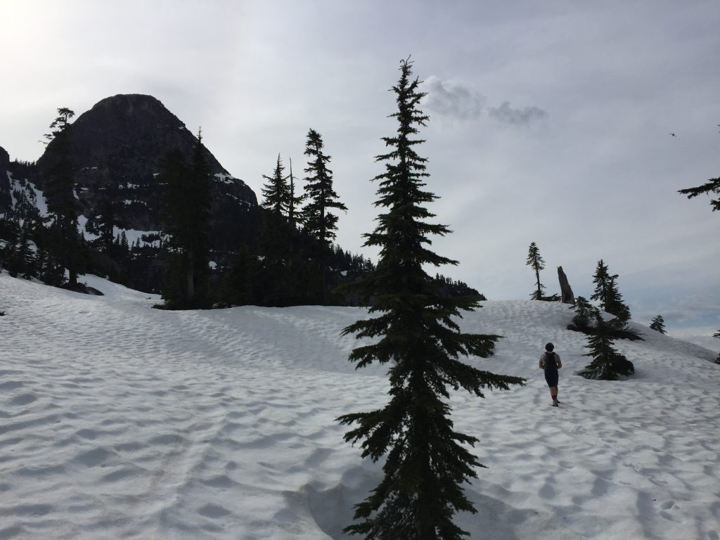
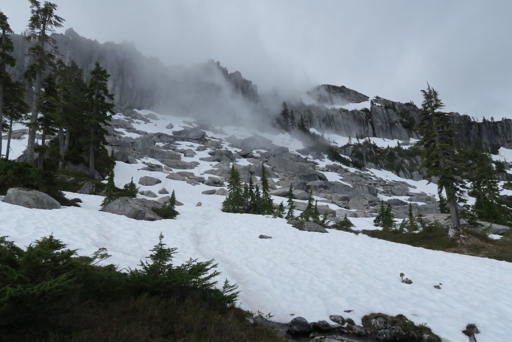
At this point, I couldn’t resist any more. It looked like all the snow had melted from the top of the dome and plenty of rock was exposed in the snow field.
On the fifth trip, Scot Ellis joined me and we were going for the top.
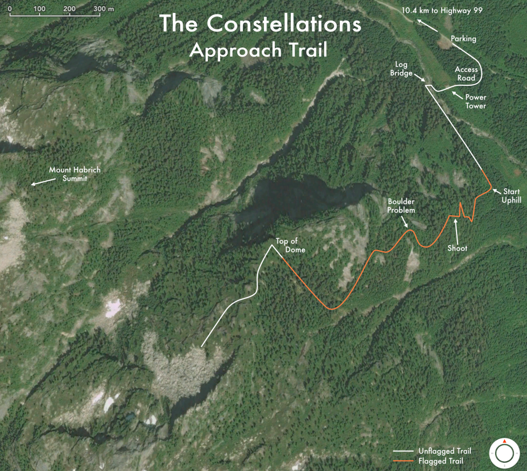
The trail is only 2.5 km long but it took us about 3 hours of bush trashing, slipping, sliding, and resting to gain the 800 meters of elevation. Every time I’ve hiked on that hillside, it is clear that taking a crash pad up is not an option without cutting a trail the whole way. It is swimming through over head bushes at times.
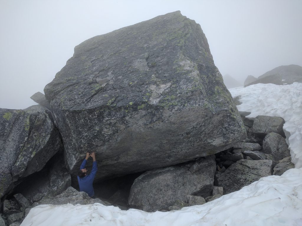
When we arrived, the upper section of a nice looking boulder field lay before us.
My worst fear was immediately dismissed. Not all of these boulders are too small. Plenty of them are small but a few of them look like they might be too big. Highballing looses a lot of its appeal when the van is not just a few meters away.
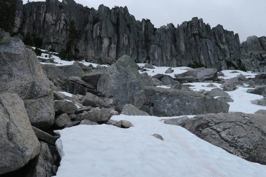
The snow was crusty and helpful as we explored the boulders. The snow melts away from the boulders leaving a gap between the rock and snow. It looks like there is still about 4 meters of snow to melt in some places. Scot and I each punched through the snow into these melted caves but fortunately stopped on the surface without falling deeper.
When we stopped to eat lunch, we cooled off enough to put on all the clothes we’d brought. I was glad to have my toque. We did have a cell connection. Apparently it was 20°C down in Squamish but it couldn’t have been more than 12°C at 1400 meters above sea level in the boulder field. That could offer nice temperature relief in the summer.
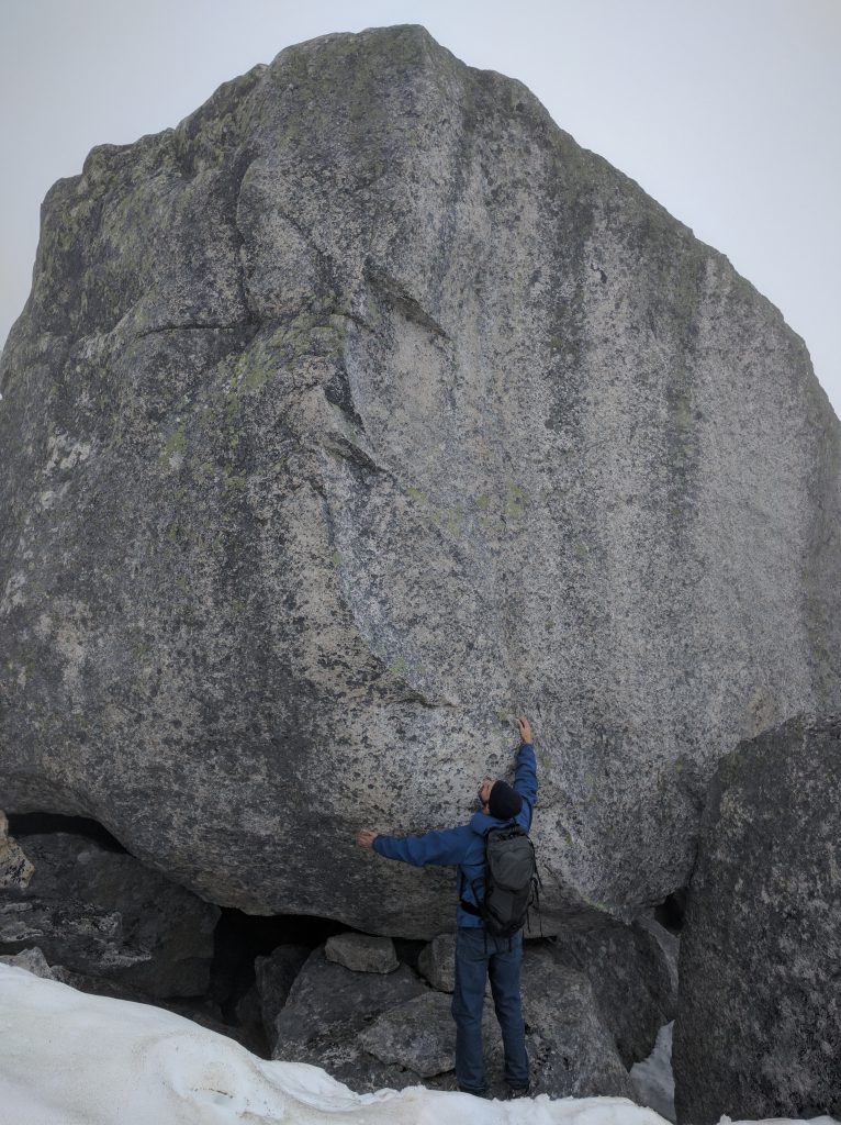
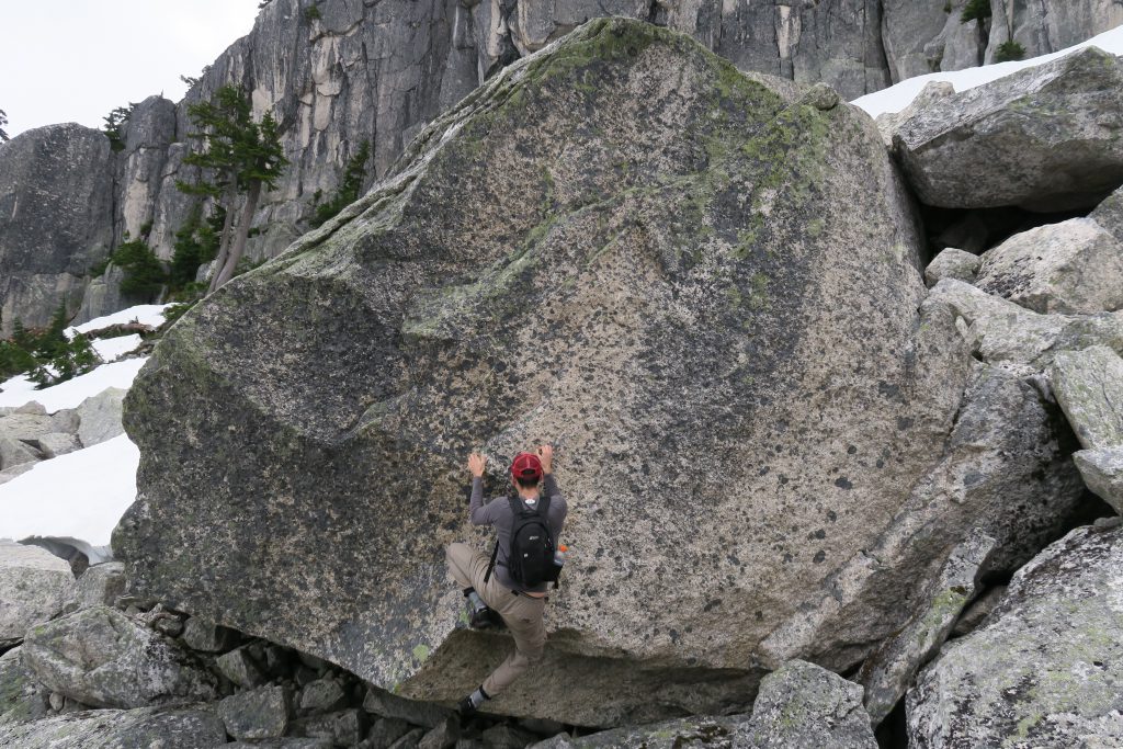
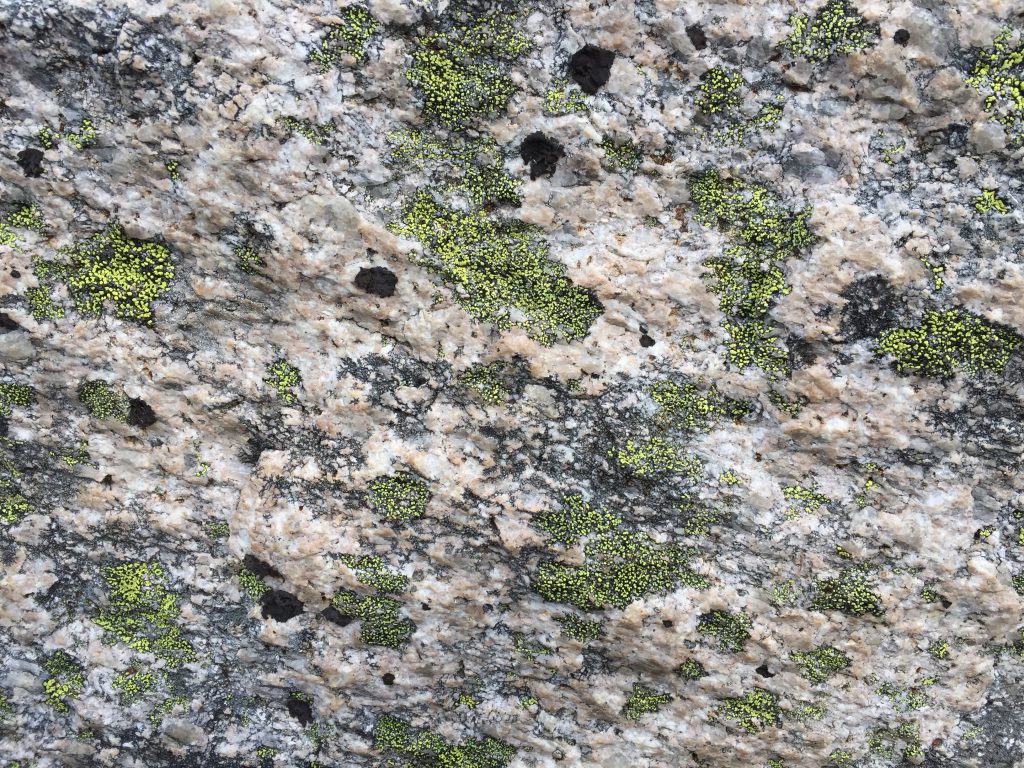
The rock is pink granite. It is good quality without many fractures. The surface crystals are well attached to the rock. Not many crumbly bits. Even some flakes looked trustworthy that would be suspect in other areas.
It was obvious that landings up there are hideous talus. The worst of the worst. With a shovel and some work, the highballs could be made quite tame until the snow has completely melted. It may be that at the right time of the year a shovel and a tarp would be enough to avoid hiking a crash pad up there at all.

The cool clouds came and went throughout our exploration.
We explored much of the field over 3 hours but as we descended to the lower boulders we just peaked down at the lower field. A lot more boulders that looked quite similar to what we’d seen.
There are plenty of easy aretes and slabs. Hundreds to be done. I’m not hiking 3 hours up a steep hill to climb a nondescript 3 meter tall V0 arete and we saw many of those. That’s not what I am searching for. I was looking for featured faces. I was looking for lines like This Monkey’s Gone to Heaven, Gibbs Cave, The Fuzz, Superfly. We were not overwhelmed by the number of these kinds of lines. After a few hours of exploring many good quality boulders, we were surprised how few lines really impressed us. It looked like old-school technical granite climbing. Not the gymnastic style we like most. Maybe 20 lines were appealing but we weren’t even all that passionate about most of those. And some of the best looking ones were highballs that said “reserved for Miles Adamson.”
During our 2.5 hour descent to the van it rained and I was glad I brought rain gear. The wet bushes and branches had me landing on my butt a few times. By the end, my knees were sore and I was glad to be back at the van 8.5 hours after we left it.
One day later, I’m looking at the pictures in this article thinking that my eyes weren’t working right up there. There are definitely some great looking lines in these photos and the rock quality really was great. As my knees start to feel better this evening, I’m thinking about going back up there. Do you want to join me?
[Update: A crashpad has made its way up there and rocks have been climbed.]
Approach
Drive 10.4 km from the Apron parking lot at Highway 99 to the north side of Mount Habrich. The road is currently in good condition with only one hill of loose cobbles. It takes me about 30 minutes to drive the gravel road comfortably.
One day, way out there, I saw the young driver of an early 1990s Toyota Corolla with a green, new driver “N” on the back who had welded the accelerator to the floor. He must have been having a great time flying along and beating the hell out of his car’s suspension. Anyway, it proved a smaller car can get up there if determined.
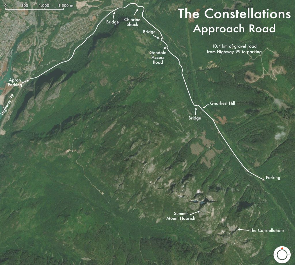
The parking area is obvious as it doubles as a shooting range. You’ll see the shotgun shells where you park and the targets across the clearing.
As I’ve tried to make clear in the article, the hike is strenuous and sketchy in places. It is quite well flagged with orange or pink flags most of the way.
Remember that you are on your own out there. Take rain gear, warm clothes, food, a headlamp and extra batteries, fully-charged mobile phone for the places that have a cell connection, bear spray, etc. Let someone know when you’ll return. Be careful.
A helicopter ride would be a nice way to get in there for a week with comfortable camping gear, food, and a load of pads. Rates seem to be $535 for 3 people or $900 for 5 people in one direction. Hiking down is not much easier than hiking up so I’d want to fly both ways with a big load of stuff.
Nice read.
Thanks for taking the time to put up this article.
Mark